

Retirement is still a long way off but it’s been creeping into more of our conversations lately. We both want our Captain’s license in hand by the time we cast off for longer voyages, and I’ve started to realize that navigation—specifically, the chart-and-compass kind—has me spooked. The math, the precision, the possibility of being “off by miles” because of a missed conversion, it’s not exactly my comfort zone. So I want to start early, to give myself plenty of time to learn (and maybe unlearn) a few things.

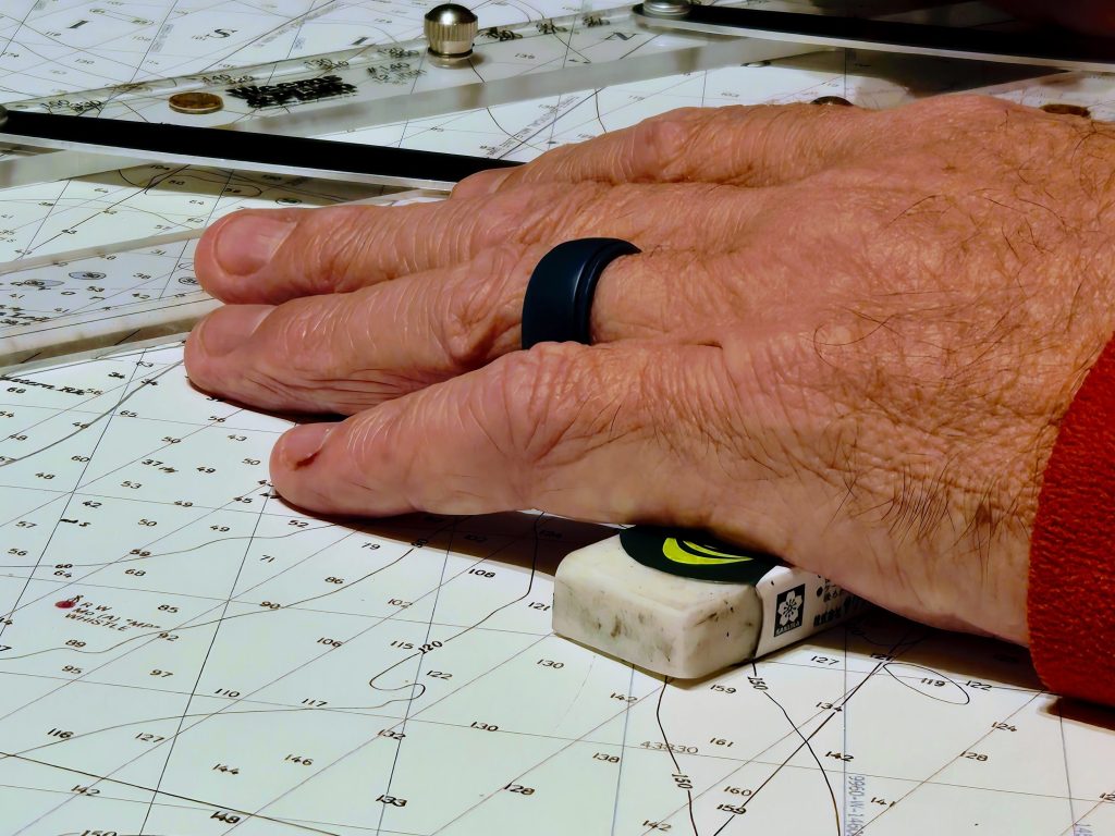
Last week, we spread a chart out on the dining table like explorers preparing for an expedition. Our tools were modest: a mechanical pencil, a compass, a divider, a parallel ruler, and a pencil eraser that kept vanishing between us. One of us would set it down for just a second, and suddenly it was gone. It became a kind of scavenger hunt every few minutes: “Where’s the eraser?” “You just had it.” “No, you just had it.”
We were working with training chart 12354 TR—Long Island Sound, Eastern Part. It’s outdated from 1990, but it’s used for the captain’s license exam, so that is what I’ll be learning on. For people who rely on GPS a lot in life, this chart is exactly like a relic from another century: lines, symbols, a compass rose, mysterious notes in italics.
Our topic for the night was the difference between magnetic north and true north. (If you recall, I asked in an earlier post: Which Way Is North? Back then, it was a kind of philosophical wondering. This time, it’s a serious question!
True north, I learned, is the direction along Earth’s surface that points toward the geographic North Pole, the fixed point used for maps and charts. Magnetic north, on the other hand, is where the compass needle points, toward the magnetic pole somewhere way up north of here. (And just to keep things interesting, it moves a little every year.)
The chart, of course, is drawn to true north. But the compass is drawn to magnetic north. Which means if you don’t convert between them correctly, you could end up miles off course. (Cue mild panic 😳)
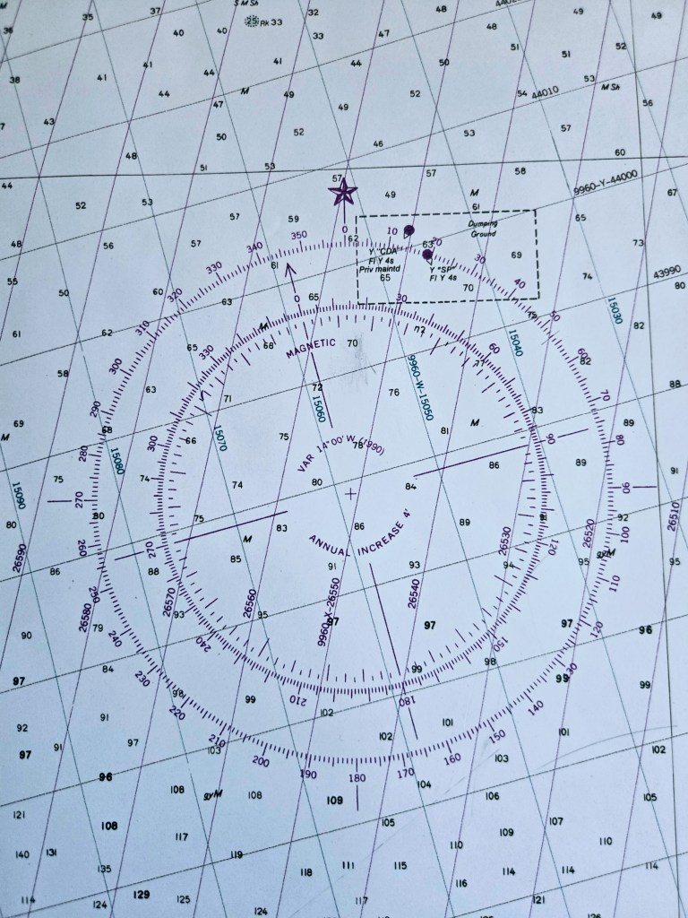
We worked through an example together. Let’s say we want to head ten miles due east on the chart, 90° True. The variation for our chart area, as indicated on the compass rose, was -14° (magnetic north = 14° west of true north). Then we applied the boat’s deviation, another –5°(because the boat can sway the compass too). When the math was done—carefully, with much checking and rechecking—we arrived at our compass heading: 71°.
To go due east, we’d actually steer 71° on the compass.
Somewhere between the eraser hunts, side tracks, and a few “wait, what??” moments, it started to click. By the end of the night, I hadn’t exactly mastered navigation, but I’m making peace with it. The lines on the chart felt a little less like gobbledygook and a little more like storytelling, plotting where we are and where we hope to go.
P.S. To his credit, Kent has all of this worked out. He’s dutifully acting as instructor right now. It’ll all pay off when we’re co-captains.
For you nerds who are actually curious about how to make the conversion:
This conversion is essential in navigation because even simple errors can result in a significant off-course position, potentially leading to running aground, collisions, or missing a critical navigational landmark. Interesting to note, using a systematic, methodical calculation method is recommended since navigators are often tired or stressed.
Before we dive in, let’s learn more about True North and Magnetic North and the difference between them.
Understanding True North and Magnetic North
- True North (T): The direction along the Earth’s surface that points toward the geographic North Pole, where the lines of longitude converge.
- Magnetic North (M): Where a standard magnetic compass needle points. The magnetic pole is not in the same location as the geographic North Pole, and it slowly moves over time.
- Magnetic Variation (V): The angular difference between True North and Magnetic North at a specific location. It is essential for converting a course plotted on the chart (True) to a course to steer by compass (Magnetic), and vice versa.
The general relationship between the two directions is: T ± V = M
Note that Variation can be applied as either positive or negative. The Variation rule relates the position of Magnetic North to True North and applies to the correction itself:
- If Magnetic North is East of True North, the variation is East.
- If Magnetic North is West of True North, the variation is West.
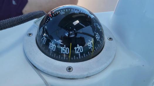
NOTE: Nautical charts display True North and Magnetic North, and Variation is indicated on the compass rose. (See picture below.)
Now let’s dive in.
Planning a Route on a Chart: Convert from True to Compass
Question: We are in a boat with our current location known, and we want to navigate to a destination that is ten miles due east (90° True) on the chart . What should our compass heading be?
If you answered 90° you’d be wrong! To answer the question accurately, we’ll need to reconcile true, magnetic, and compass courses. This conversion is a simple math equation, but it has a couple of key variables.
The 2 Step Conversion
Converting a course on a chart into the vessel’s compass heading involves two steps:
Step 1: Convert True course (T) to Magnetic course (M).
Since there is an angular difference between True North and Magnetic North, referred to as Magnetic Variation (V), step 1 corrects for the difference. Depending on their relative locations, the correction will be additive or subtractive.
Step 2: Convert Magnetic course (M) to Compass course (C).
We’d be good to go if it were not for the fact that the vessel’s own magnetic fields from equipment like engines and electric wires cause a discrepancy between a boat’s compass reading and the direction of magnetic north, referred to as Deviation (D). Step 2 corrects for Devation and like Variation, the correction will be additive or subtractive.
The Sequence
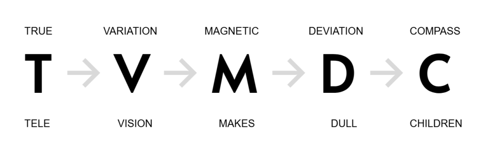
The equation uses a sequence to convert a True course (T) to a Compass course (C), following the path: T → V → M → D → C.
- T – True Course, measured from True North.
- V – Magnetic Variation, the angle between True North and Magnetic North.
- M – Magnetic Course, measured from Magnetic North.
- D – Deviation, the compass error from Magnetic North specific to the boat and its heading.
- C – Compass Course, the reading on the boat’s compass.
PRO TIP: Remember the sequence using the mnemonic phrase: “Tele Vision Makes Dull Children”
NOTE: It is important to apply the corrections for both Variation (V) and Deviation (D) consistently from left to right (T to M, and M to C) in the sequence.
Step-by-Step Reconciliation
Using our example from above: We are in a boat and want to travel to a particular destination that, according to the chart, is ten miles due east (90° True).
We know our True Course is 90°.
Step 1: Convert True Course (T) to Magnetic Course (M)
Magnetic Variation (V) is the angular difference between True North and Magnetic North at a specific location. We can see on the compass rose that Magnetic North is west of True North, offset by -14°. (The degree of variation depends on where you are in the world. Magnetic North is west of True North for most of the US and the Caribbean.)
To find the Magnetic Course (M) from the True Course (T), we apply the Variation (V):

T ± V = M

90° - 14° = 76°
Now we know our Magnetic Course (M) is 76°.
Step 2: Convert Magnetic Course (M) to Compass Course (C)
Boat deviation is the angular difference between a boat’s compass reading and the direction of magnetic north, and is expressed in degrees east or west. The values and sign are specific to the boat and can be found on the boat’s deviation card which lists the specific error for each compass heading the boat might be on. For example, it might show a 2° West deviation when heading due north, and no deviation when heading south.
The rule for correcting for Deviation is:
- East deviation is subtracted to obtain a more “correct” bearing.
- West deviation is added to obtain a more “correct” bearing.
PRO TIP: Remember the rule using the mnemonic phrase: “East is least (subtract), West is best (add).”
In this case, Deviation is 5° East, which means we will subtract.
To find the Compass Course (C) from the Magnetic Course (M), we apply the Deviation (D):

M ± D = C

76° - 5° = 71°
Now we know our Compass Course (C) is 71°.
Answer: To arrive at our destination – to go due east in our boat – we will steer with a compass heading of 71°.
Reverse Conversions
If a navigator needs to work backward (for example, converting a Compass Course into a True Course to plot on a chart), they must generally reverse the steps and the corresponding sign conventions.
Bonus pic of Northern Lights over central Iowa!

Discover more from SAIL & SAVOR BLOG
Subscribe to get the latest posts sent to your email.
